How to Spend 2 Days in Aso-Kuju National Park: Volcano Views, Onsen, and Hiking
Aso-Kuju National Park is one of the clearest places in Japan to see how volcanic activity shapes the landscape. In central Kyushu, the park brings together Mount Aso and its vast caldera, the Kuju Mountains, and the Mount Yufu area near Yufuin. If you only have two days, the most efficient approach is to pair a first day of volcano scenery and caldera viewpoints with an overnight stay in an onsen town, then spend the second day hiking in the Kuju Mountains.
Why this park deserves a place on a Kyushu itinerary
For travelers planning a short Japan trip, Aso-Kuju National Park offers a concentrated look at volcanic landscapes in Kyushu. The scale is part of the appeal: the park includes a giant caldera, active volcanic slopes, grass-covered highlands, mountain ridges, wetlands, and hot spring towns. That combination makes it possible to see dramatic scenery without needing a long stay.
The best part is that the park is not just about views from a distance. You can drive across the caldera floor, look out from the outer rim, walk through Kusasenri, stay in an onsen ryokan, and then move on to hiking trails in the Kuju Mountains. For a traveler with limited time, that mix of scenery and activity is exactly what makes the area so rewarding.
A simple 2-day route
The most practical way to cover the park in two days is to start from Kumamoto City, spend the first day around Aso, stay overnight near Sujiyu Onsen, and use the second day for the Kuju area.
A rental car gives the most freedom for this kind of trip. Travel around the park is possible by train and bus, but a car makes it much easier to move between viewpoints, trailheads, and the onsen area without losing time.
Day 1: Mount Aso, Kusasenri, and a caldera viewpoint
Start by heading from Kumamoto City to Aso. From there, focus on the inner landscape of the caldera rather than trying to rush across the whole park.
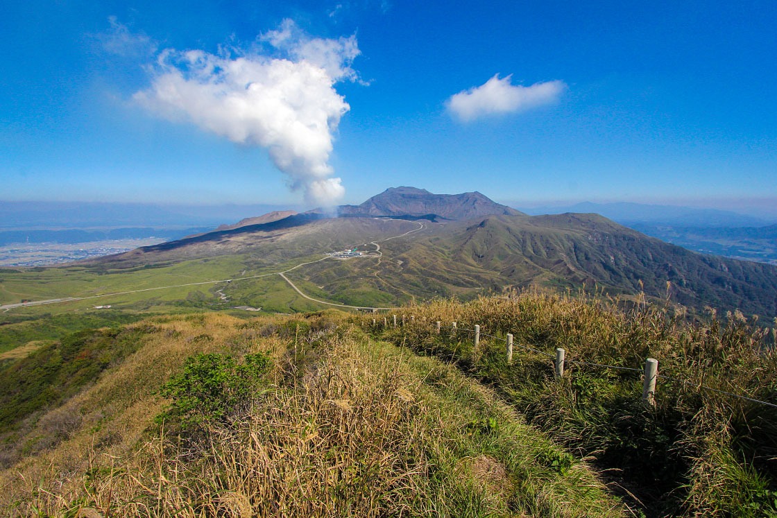
As you approach the caldera, the first thing that stands out is the scale. The area opens into a broad bowl-like landscape filled with rural towns, rice fields, and the mountains at its center. These central peaks are known as Mount Aso.
One of the most distinctive features here is how open the slopes feel. Instead of thick forest, much of the mountain landscape is covered in grasses, including susuki. In the right season, those grasses can give the hills a soft, glowing look. Horses and cattle also appear in the meadows, which adds to the pastoral feel of the area.
Kusasenri
Before reaching the crater area, make time for Kusasenri, the wide grass-covered highland near the center of the caldera. It is a quiet place to slow down and take in the volcanic setting. The open field sits beneath the crater area and gives you a sense of how unusual this landscape is.
If you want a short walk, the area around Mt. Eboshi can be a good choice. A hike here can be done in under an hour and gives a stronger feel for the terrain than simply stopping for a photo.
Naka-dake crater area
From Kusasenri, continue toward the crater area if access is allowed. This is the place that shows how active Mount Aso really is. The crater area can be dangerous because of poisonous gas and the ongoing risk of eruption, and the area is sometimes closed entirely for safety.
If you plan to go, check current warning levels and access conditions before setting out. The crater area is not something to assume will be open, and even when access is allowed, conditions around the crater can be intense.
Daikanbo
After leaving the crater area, head to Daikanbo on the northern rim of the caldera. This viewpoint is one of the best ways to understand the size of the whole basin. From above, you can look out over the patchwork of fields and buildings below with Mount Aso rising in the center, while the surrounding wall of the caldera frames the entire landscape.
For a short itinerary, Daikanbo is especially useful because it turns the day into a complete circuit: inner caldera scenery, a close look at the volcanic center, and then a wide panorama from above.
Overnight base: Sujiyu Onsen
After a full day of driving and sightseeing, head north along the Yamanami Highway to Sujiyu Onsen. This is a practical overnight base for the route because it sits near the Kuju area and keeps you well placed for the next day’s hike.
The Yamanami Highway itself is part of the appeal, running through the northern part of the park and offering scenic driving between the Aso side and the Kuju side.
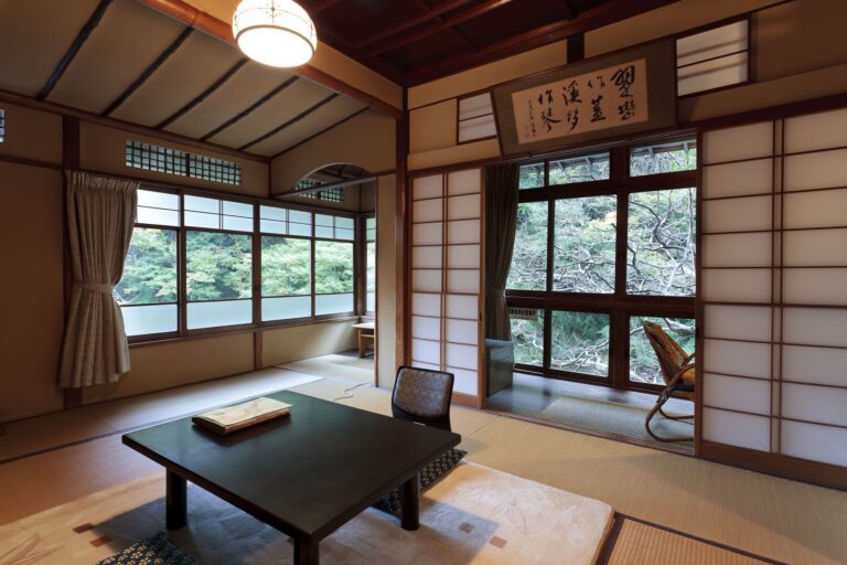
An onsen ryokan works particularly well for this itinerary because the trip is built around movement and scenery. After a day of road travel and viewpoints, staying in a traditional inn lets you enjoy the hot spring side of the park without adding another transfer. The example accommodation in the route includes both indoor and outdoor baths, with a private outdoor bath in the room.
Day 2: Tadewara Wetlands and the Kuju Mountains
The second day is for the Kuju Mountains, the tallest mountains in Kyushu. This part of the park gives the itinerary a different rhythm: less driving between scenic stops and more time on foot.
Tadewara Wetlands
Begin at Tadewara Wetlands, which lies a short drive from Sujiyu Onsen. The marshland sits at the foot of the Kuju Mountains and is known for boardwalk trails through a wide open landscape of grasses and wetland plants.
This is a good first stop because it eases you into the mountain day without demanding a difficult hike right away. It is also a very different landscape from the caldera scenery of Day 1, so the contrast helps show the variety inside the park.
Makinoto Pass and the Kuju trailhead
From Tadewara, continue to Makinoto Pass, which serves as a convenient trailhead for the Kuju Mountains. From here, it is a straightforward place to begin a hike into the higher ridges.
A climb from the trailhead can get you up to the ridge line in about an hour, depending on your route and pace. Once on the ridge, the views open out in all directions, and the mountain landscape feels much broader than the map may suggest.
If you have more time, you could spend longer hiking here. But if your trip is short, focusing on one main summit or ridge section keeps the day manageable.
Mt. Kuju
For a two-day itinerary, Mt. Kuju is a strong goal if you want to anchor the day with a clear hiking destination. From the summit, you can look south over the Aso area, and on a clear day the smoke from Naka-dake was visible from nearly 50 kilometers away in the route described here.
That long view is what makes this itinerary feel complete. On Day 1, you see Aso from within and from above. On Day 2, you look back toward it from the Kuju side and understand how the whole volcanic landscape fits together.
Volcano safety and crater access
One of the most important planning points for Aso-Kuju National Park is that Mount Aso is active. The crater area around Naka-dake can be restricted or closed when volcanic conditions become too hazardous.
That means a flexible plan is important. If the crater area is open, you can include it in Day 1. If it is closed, you can still enjoy Kusasenri and Daikanbo and build a very satisfying itinerary without relying on crater access.
Before you go, check current warning levels and access conditions for Naka-dake rather than assuming the area is open.
What kind of traveler this itinerary suits
This two-day route works best for travelers who want to combine scenery and activity without overcomplicating the trip.
It is a good fit if you:
- want a focused Kyushu hiking trip with a strong volcanic landscape component
- prefer a self-drive itinerary with flexibility
- want to spend one night in an onsen town
- are comfortable with a route that depends on current volcano access conditions
- want a trip that balances viewpoint stops with a real hike
It is less suitable if you want to rely heavily on public transport or if you are hoping for a very relaxed, slow-paced trip with minimal movement.
Practical planning notes
Aso-Kuju National Park is easiest to enjoy when you keep the pace realistic. The area covers a lot of ground, and the best version of this itinerary is one that leaves space for detours, photo stops, and access changes around the crater.
The route also works best if you think of it as a circuit rather than a one-way sightseeing list: Kumamoto to Aso on Day 1, then north through the Yamanami Highway area to Sujiyu Onsen, followed by the Kuju Mountains on Day 2.
If you are combining this with a broader Kyushu trip, the park can work well as a scenic inland detour between other destinations in the region.
FAQ
Is Aso-Kuju National Park better visited by car?
A car offers the most freedom and saves time, especially if you want to see Aso, Daikanbo, Sujiyu Onsen, Tadewara Wetlands, and the Kuju trailhead in just two days. Train and bus travel is possible, but less flexible.
Can you see Mount Aso and the caldera in one day?
Yes. A first day focused on the caldera, Kusasenri, the crater area if open, and Daikanbo is a practical way to experience the Aso side of the park.
Is it safe to visit the Naka-dake crater area?
Access depends on volcanic conditions. The crater area can be closed when the danger is too high, and even when it is open, gases near the crater can be intense. Check the current warning levels and access conditions before visiting.
Where is a good place to stay overnight in the park?
Sujiyu Onsen is a practical overnight base for this itinerary because it sits near the Kuju area and works well with the Yamanami Highway route.
Can beginners hike in the Kuju Mountains?
The itinerary described here includes a manageable route from Makinoto Pass to the ridge line, and the area can also be enjoyed at a gentler pace through Tadewara Wetlands. If you want a shorter day, that combination works well.
What is the best way to combine sightseeing and hiking in Aso-Kuju National Park?
A balanced two-day plan works best: spend Day 1 on Aso, the caldera, Kusasenri, and Daikanbo; stay overnight in Sujiyu Onsen; then use Day 2 for Tadewara Wetlands and a Kuju Mountains hike. That structure keeps the trip efficient while still giving you time to enjoy both the volcano scenery and the trails.
If you are building a longer Kyushu route and want help turning this into a wider trip plan, Aso-Kuju is easy to connect with other stops in central and southern Kyushu.